Monday’s extreme wind gusts ushered in a reinforcing dose of cold air that will stay with us through the workweek.
The gusts have relaxed somewhat, but they still have a bite on exposed skin. And the cold trend will continue – especially
during the mornings this week.
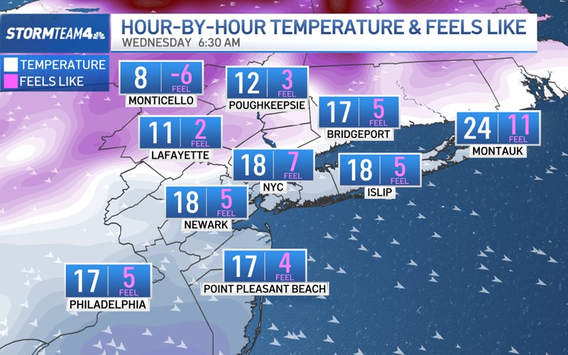
Lows Wednesday morning will dip into the teens and single digits across the area as winds continue to gust 20-25mph.
This will result in single-digit wind chills across New Jersey and the metro area. Parts of the Hudson Valley will be waking
up to sub-zero wind chills. Make sure you’re properly bundled up before heading outside; do not leave bare skin exposed.
Thursday morning will be more of the same. Winds will be marginally less gusty, so in lieu of wind chills in the single digits,
most will feel like the low teens, but the bottom line is: it is going to be bitterly cold, keep the parkas and scarves on.

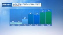
Daytime temperatures won’t be much better; we’re stuck below freezing through Thursday.
If you’re tired of the cold, here’s the good news: temperatures start to moderate as we head into the weekend.
Highs will climb back into the 40s; even our low temperatures will get above freezing by the start next week. And if that still
doesn’t sound warm enough, just give it time; spring is only 30 days away.